
The Benefits of Real-time Groundwater Monitoring

Adroit spoke with Tonkin + Taylor Senior Engineering Geologist, Ben Westgate about their groundwater measurement processes and how real-time digital groundwater monitoring is providing an important new tool for the company, for minimising the impact on the environment from projects they’re a part of.
Tonkin + Taylor is one New Zealand’s leading environmental and engineering consultancies. Key competencies include land, water, coastal, waste management, and natural hazards services, with a focus on sustainable and resilient solutions to complex environmental and engineering challenges. Notable projects include in the transport and infrastructure space North Canterbury Transport Infrastructure Recovery (NCTIR): Kaikōura, Pūhoi to Warkworth Motorway, Waterview Connection, Auckland through to Commercial Bay Queen Street, Auckland CBD, then the natural hazard and resilience work in Hawke’s Bay Coastal Hazard Risk Strategy and Local Government New Zealand National Sea Level Rise Exposure Survey along with multiple smaller construction and foundation projects.
Senior Engineering Geologist, Ben Westgate has 17 years post-research experience, having moved to New Zealand from the UK six years ago. His varied work history includes experience in civil construction and mining working on projects in Eurasia, Asia, Russia, West Africa and Europe.
With Tonkin + Taylor, Westgate has been engaged primarily in an engineering geology capacity, looking at optimizations of ground investigations, including key issues of: “how we obtain and use data, and how we can take the mundane or repetitive work out of what we do every day.”
It reduces people’s time in the field, reduces vehicle movements, and lowers our carbon footprint as well. And it also means we’re not putting people in potentially hazardous situations, whether that’s driving to a remote site or just continually driving in traffic or around the country collecting data.
There’s technology now that can do everything for us, and we just need to start to utilise it. And the more that we utilise it, the lower the unit costs become, which increases utilisation and confidence in our analysis and reporting.
It’s just starting the process that’s the hard bit

Measuring Groundwater
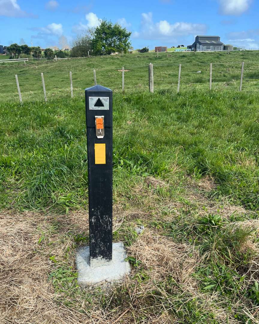
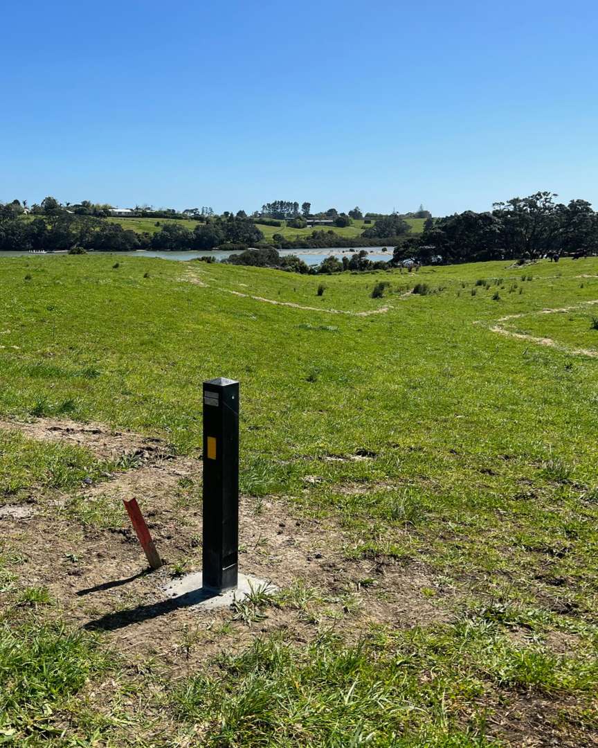
Recently Tonkin + Taylor has been working with Adroit, Spark and EWS to establish groundwater installations in Auckland to deliver 24-hour live data. These installations are focused on the technical effects assessments for the project and creating pre-construction baselines based on the data recorded in the field.
T+T is utilising the EWS satellite and cellular networks that accurately and reliably report changes in groundwater or ground movement. Data from the sensors feeds into the Adroit Platform where it can be viewed from a T+T perspective. The raw data can then be processed and fed into a ground monitoring portal for stakeholders, clients and regulatory authorities to see. Other inputs such as geotechnical data, cross sections, maps, plans and rainfall data can then be added to the portal. Once the construction process starts the up-to-date progress can be modelled and reported from pre-set alert and alarm levels.
Benefits and Opportunities
So, what is the payback for Tonkin + Taylor? Is it a desire to improve their own internal environmental processes or motivated more by compliance with Council or WorkSafe regulations?
“I think there are multiple touch points,” says Westgate.
“We need to know more about the environment that we engineer and construct in. With real-time data it allows more informed decision making.
There is currently a shortage of technical consultants, so if we can utilise their time more efficiently, it has huge benefits for projects, moral and personal wellbeing. This allows TT’s staff to work smarter and not necessarily harder. To become more digitally enabled turning digital products and workflows into normal practice,”
“Digital data enables projects to be run proactive as opposed to reactive. Reactive management is generally extremely expensive, time-consuming and ends up in Court. Whereas if we can be proactive you can stop damage from occurring or at least you have the knowledge to be able to be proactive. This probably saves considerable costs, improves industry perception and those involved in the project,” he says.
“Real-time data will be really powerful moving forward when we can start to twin more devices together. Whether we look at groundwater level, turbidity or dissolved oxygen or pH, so that we understand groundwater mineralogy or potential contamination and physical movements through tilt or inclination.
“I think that’s where the real advances are going to be in the future, where you just don’t do one thing, you do five or six or seven or eight. And then that’s going to have huge benefits because you’re going to have a full understanding of the full suite of data. And then it can be used on multiple projects from compliance work to construction sites to pipelines to landfills to tailings dams to building foundations,” he says.
Looking Ahead
Westgate expects that future environmental regulations are going to be much more stringent and will put the emphasis on data to prove compliance – as opposed to a reliance on expert advice or reactive remediation.
“It’s always easier to prove something with data, as opposed to not having it.
“And the telemetry actually provides data that’s already pre-processed – it’s already done, it’s finished, it’s clean. You can immediately see if there’s anything untoward in it. You’re not waiting for three or four months to go and download different devices.
But as soon as that becomes four to six months, then I think manual monitoring will become a thing of the past.